
Building Tamermap: A Map for Pokémon Card Collectors and Local Shops
Explore how Tamermap combines interactive maps, card shop listings, hunt-planning tools, and shop-owner features in a custom web application.
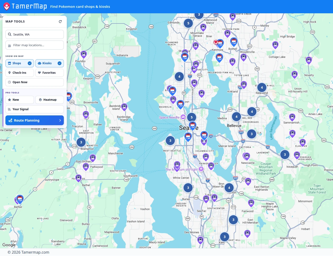
Tamermap is a location-based web application that helps Pokémon card collectors find independent card shops and vending kiosks on an interactive map. Collectors can check public business details, narrow the map with filters, plan a multi-stop hunt, and keep private records of places they have visited.
The same product gives independent shops a free way to claim listings and maintain the information collectors rely on. That two-sided design makes Tamermap more than a directory: it is a working example of software built around different users who share one practical problem. Tamermap is an independent software project developed and operated by the consultant behind North Sound Technology Advisory.

Finding the right shop shouldn’t require ten different websites
A collector planning a Saturday trip may bounce among search results, shop websites, social pages, and separate kiosk lists just to answer three questions: what is nearby, when is it open, and which stops make a sensible route? Tamermap brings those tasks into one map, with independent card shops treated as destinations and vending kiosks available as additional stops.
The information is only as useful as it is current. Shops change hours, move, or close, while some listings have incomplete details. Tamermap therefore combines maintained location records with owner corrections and claims. It improves discovery without pretending that every listing is perfect—or that a shop shown on the map has cards in stock.
More than a map of card shops
The collector experience follows the decisions involved in a real outing. A user can search an area, compare nearby shops and kiosks, review public hours and contact information where available, and filter the visible results. “Open Now” uses published operating hours; it is a planning aid, not a guarantee that a door is open or product is available.
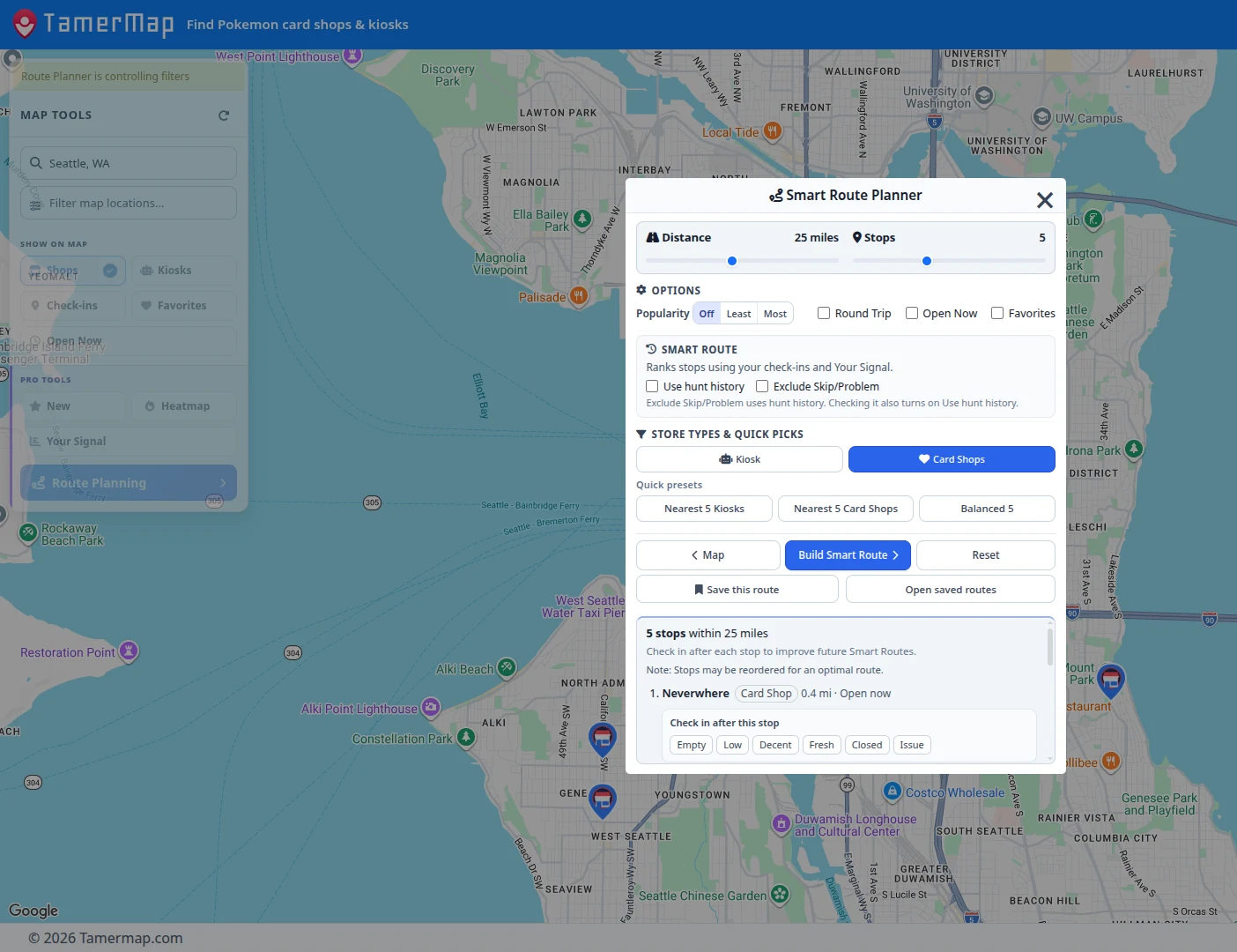
From there, route planning turns a group of pins into a multi-stop trip. A free Basic account adds private check-ins, notes, Hunt History, and a personal “Your Signal” for each location. Those records help a collector remember what happened on previous visits without creating a public activity feed. Optional Pro tools extend that workflow with Smart Routes, saved hunt routes, activity heatmaps, map-wide Signal filtering, and a filter for newly added locations.
Giving independent card shops a place on the map
Tamermap also has to work for the businesses collectors hope to find. An independent shop owner can claim an existing listing for free. After approval, the owner dashboard provides controls for business hours, contact details, descriptions, notices, and storefront photography.
Optional Spotlight features give participating shops a richer presentation, including additional profile and gallery elements. They do not purchase preferential route ranking. That distinction matters: the collector side depends on useful, credible planning, while the merchant side needs practical tools for presenting accurate public information. Serving both audiences in one application requires clear boundaries between discovery, listing management, and paid presentation features.
The technology behind the map
Location data is the foundation, but storing coordinates is only the beginning. Records need useful business details, hours need to support filters, and a dense field of markers has to remain navigable on both a desktop screen and a phone. The interface must reveal enough information to support a decision without burying the map under controls.
The more interesting work is turning those records into tools. Search, operating hours, map filters, route planning, and private visit history each answer a different part of the same question: where should a collector go next? Their value comes from working together while keeping activity heatmaps and personal observations clearly separate from live inventory—which Tamermap does not provide.
Underneath that experience is a custom web application built with Python and Flask, PostgreSQL-backed location data, Google Maps, and cloud infrastructure that includes Cloudflare. The collector map and shop-owner dashboard share data, but they present different workflows. Keeping those experiences coherent is as much a product-design problem as a programming one.
Free access and optional tools
Core map browsing is free, and every active shop and kiosk is available without a paid subscription. A free Basic account adds private visit memory. Pro is an optional collector subscription for advanced planning tools. Shop owners can claim listings free of charge, while Spotlight is a separate merchant presentation offering. None of those paid features promises inventory, successful hunts, store traffic, or sales.
And then there’s Hunter
Hunter is Tamermap’s raccoon card-hunting mascot and a visual stand-in for the collector experience. He scouts stops, plans loops, and remembers earlier visits—while making no claim to know what is on a shelf. His personality gives a recognizable identity to a product built around maps and practical decisions, with just enough humor to make route planning feel less clinical.
From a practical problem to a working product
Tamermap illustrates what practical software development looks like after the map first appears on screen. Different users need different controls. Complex location information must become understandable actions. Free access and optional services need boundaries that make sense, and a working application must keep adapting as data, devices, and user expectations change.
The result is not a promise that every card hunt will succeed. It is a useful system for making the next trip more informed—and an example of the grounded technology experience behind North Sound.